
GPS Without Internet: How to Navigate When There's No Signal
You're in the mountains, in the woods or far from the city and your phone has no signal, does that mean you can no longer use GPS? Discover how navigation works without Internet, why offline maps are important and how to prepare before setting off.
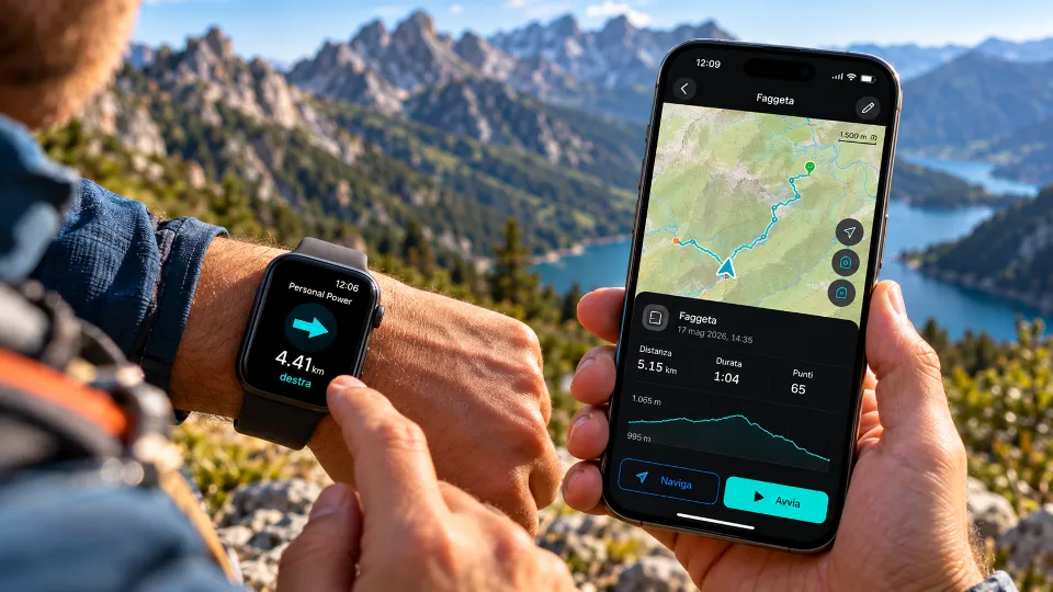
When Your Phone Loses Signal
You've left the city behind, the trail climbs through the trees and the landscape becomes increasingly beautiful, every now and then you stop to admire the view, take a photograph or check how far you've walked, then you look at your smartphone and realize there's no longer any signal, no data connection, no way to access a webpage and the map you were using seems to have stopped loading.
It's a common situation when hiking in the mountains, in forests, along less-traveled coastlines and in all those areas where cellular coverage is limited.
The first question that comes to mind is simple, does GPS work without Internet?
The answer is yes, but to understand what you can still do with your smartphone it's important to distinguish between three things that are often confused, GPS, cellular connectivity and maps.
GPS Doesn't Need a Cellular Network
When we use a smartphone to find our way, we're used to seeing our position represented by a dot on a map, it might seem that everything depends on an Internet connection, but that's not the case.
GPS is a satellite positioning system, the receiver inside your smartphone uses signals from satellites to determine its geographic location, this process doesn't necessarily require a connection to a cellular network.
So even when your phone has no signal, the device can continue determining its position, recording movements and providing geographic coordinates, of course, accuracy depends on reception conditions.
Particularly dense forests, rock faces, narrow valleys and other obstacles can make it harder to receive satellite signals, furthermore, without a data connection, acquiring your initial position may take longer.
Having no phone signal, therefore, doesn't necessarily mean you've lost GPS reception.
Why a Map Can Disappear Even When GPS Is Working
Imagine you're on a trail and can still see your position, but the roads, paths and details of the surrounding terrain are no longer visible.
GPS might be working perfectly, while the map data is unavailable.
This happens because geographic positioning and maps are two separate things.
GPS tells you where you are, the map allows you to understand that position in relation to the surrounding terrain.
Many applications download map data over the Internet while they're being used, but when the connection is lost, sections of the map that haven't yet been downloaded might not appear.
This is exactly where offline maps come in.
Offline Maps, Preparing Your Journey Before Setting Off
An offline map is map data that is downloaded and stored on your device before use, once it's available locally, you can consult it even without an Internet connection.
With GeoFix you can download offline maps for supported areas and prepare the maps you need for your outdoor activities in advance.
Before a hike you can identify the area you intend to visit, download the corresponding map and check that it's actually available on your phone.
When you're outside cellular coverage, you'll still be able to consult the map details available within the downloaded area.
It's important to remember that an offline map doesn't necessarily include every trail or feature of the terrain, the completeness of the information depends on the available map data.
Downloading a map doesn't make a route safe either, trail conditions must always be assessed on site.
Recording a Route Even Without a Connection
One of the most interesting capabilities of GPS is preserving a track of your movements.
Imagine starting a walk along a mountain trail, crossing a forest and reaching a scenic viewpoint.
Along the way your smartphone can progressively detect your geographic positions.
With GeoFix you can start recording a GPS track and preserve the route you've traveled even when cellular connectivity is unavailable, provided your device can adequately receive positioning signals.
The track represents the route detected during your journey and can help you reconstruct where you've been, you don't need to know every turn in advance or always follow a predetermined itinerary, you can explore, observe your surroundings and keep a record of the path you've taken.
The quality of the recording still depends on positioning accuracy, environmental conditions and the proper functioning of your device.
Waypoints, Remembering Important Places
During a hike not every place has a name or an address, it might be the parking area where you left your car, a spring, a scenic viewpoint or a particular fork in the trail, these are places you might want to find again, even after a long time.
With GeoFix you can save these locations as waypoints, associating a geographic reference with a place that holds meaning for you.
A waypoint can help you identify a destination or recognize an important point along your route, but knowing the coordinates of a place doesn't necessarily mean knowing which path to take to reach it, in fact there could be natural obstacles, elevation changes, streams or inaccessible sections between you and that location.
That's why it's always important to distinguish between a geographic direction and a route that's actually passable.
Track Back, Using Your Recorded Track to Find the Way Back
When you explore a natural environment, the route you took on the way out can become a valuable reference for your return journey.
With GeoFix's Track Back feature you can use your recorded GPS track to help retrace your steps toward your starting point.
Instead of relying exclusively on memory, you can consult the route you've already traveled and compare it with your current position, this is particularly useful when you've passed numerous trail junctions or when the landscape looks different from how it appeared on the way out.
Track Back doesn't eliminate the risks of the natural environment, a trail might have become impassable or present different conditions compared to when you first crossed it, the track should therefore be considered a navigation aid, to be used alongside terrain assessment and normal safety precautions.
Five Things to Do Before Heading Out Without a Connection
Knowing that GPS can work without Internet is useful, but preparation remains essential.
- Download offline maps, check that the area you intend to explore is available and that the maps can be consulted without a connection.
- Check that GPS is working, make sure location services are enabled and that the app has the necessary permissions.
- Save important locations, record your parking spot, starting point and any useful landmarks along your route.
- Prepare your route recording, start recording your GPS track before you begin walking and check that recording is actually active.
- Protect your battery life, check your battery level, consider carrying an additional power source and don't rely exclusively on your smartphone for safety.
Before setting out on a hike it's also important to know the trail conditions, check the weather forecast and let someone know your planned route.
If you lose your bearings, avoid continuing without reliable references, stop, assess the situation and, in case of difficulty or danger, contact emergency services whenever possible.
The Freedom to Explore Doesn't Depend on Signal
There are places where Internet connectivity reaches everywhere and others where it disappears after just a few steps, a forest, a hidden valley, a coastal trail or a route far from populated areas.
These are often the very places that give us the most beautiful experiences.
Technology should help us enjoy them, without forcing us to remain constantly connected.
Understanding how GPS works, preparing offline maps and recording your routes means exploring with more tools at your disposal, not to replace awareness or experience, but to have useful references when you need them.
Because the signal may end, but the trail continues.
Discover GeoFix GPS
Record your routes, save waypoints, prepare offline maps and discover the Track Back feature.
Discover GeoFix at geofixgps.com
GeoFix, wherever you go.