⌖
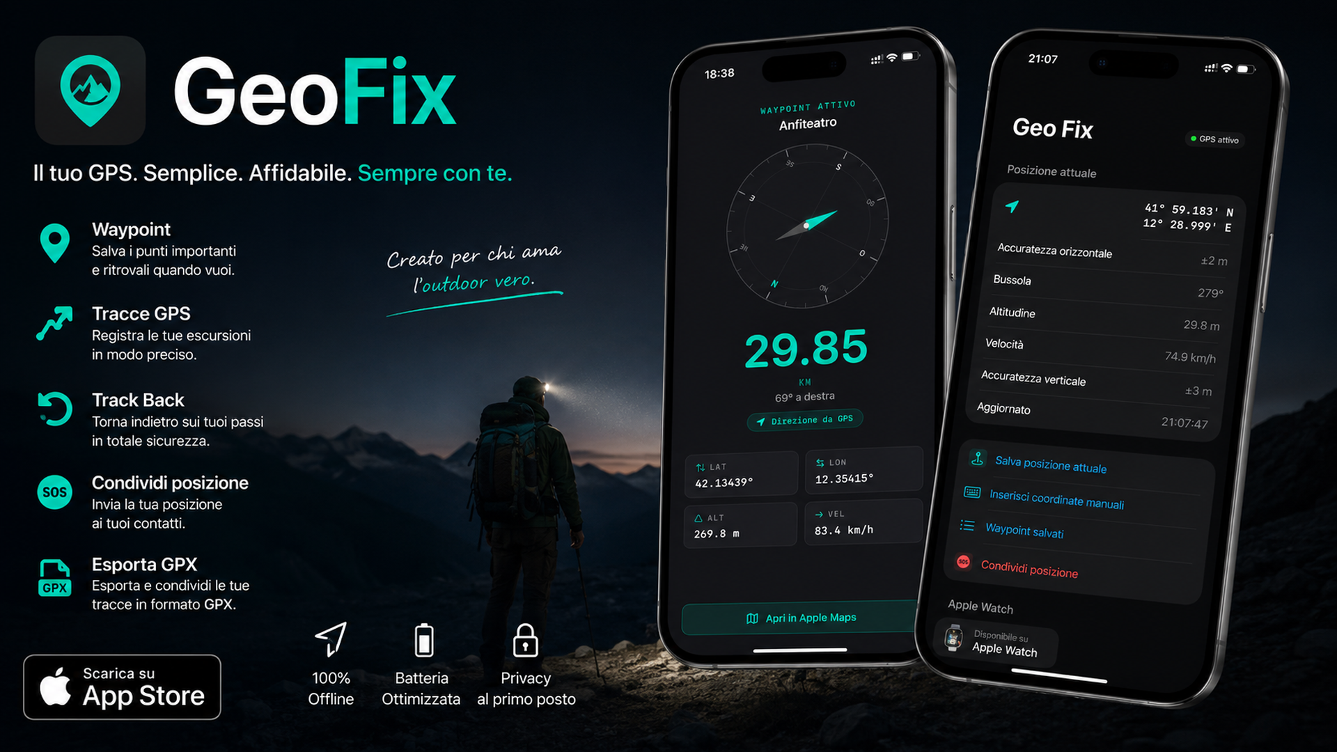
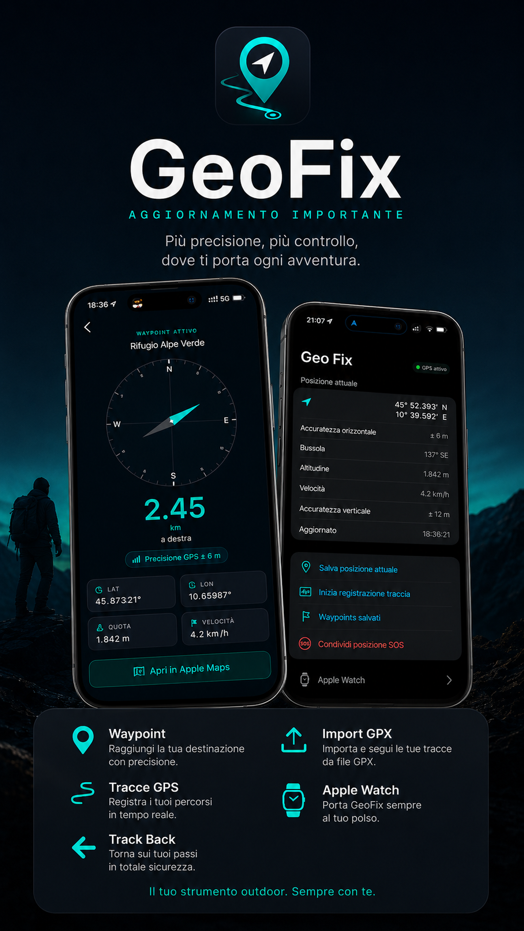
GPS waypoints
Save GPS points, rename references and keep important coordinates at hand.
GeoFix is an outdoor GPS app for iPhone and Apple Watch: save GPS points, record tracks, use Track Back and manage GPX without complex maps.
Free basic version · Premium for GPX import/export, Apple Watch and unlimited tracks · Local data
Waypoints, GPS tracks, GPX, Apple Watch and CarPlay.
GeoFix is not built to replace a full mapping platform. It is for simple, local GPS references when you are outdoors.
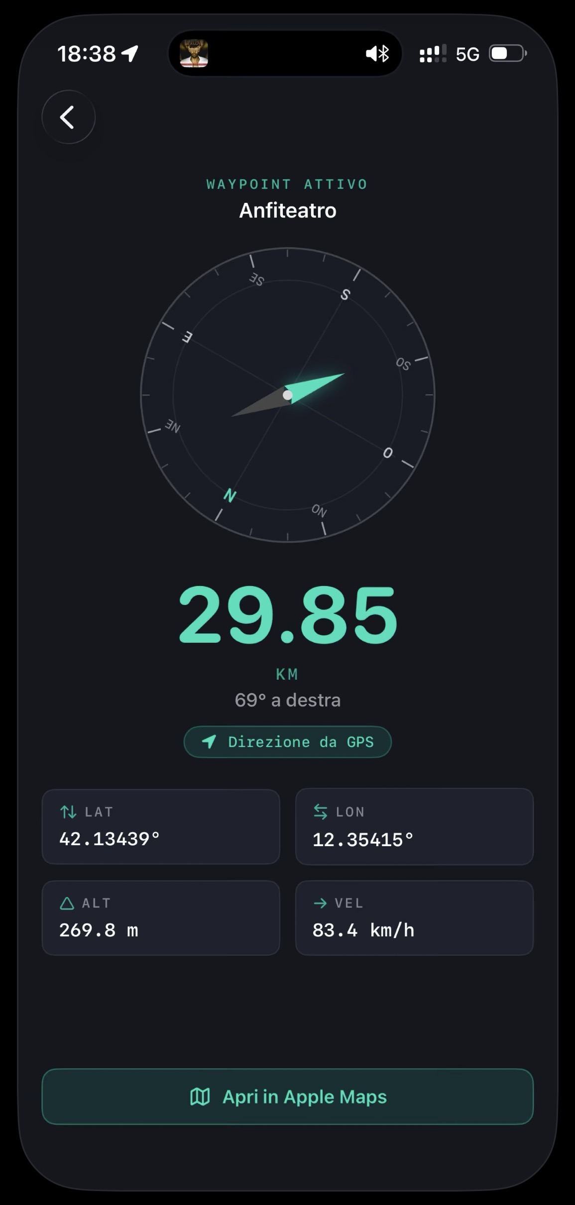
Save your car, shelter, base camp or trailhead before you start.
Keep a GPS track of your walk, with distance, duration and recorded points.
Use the recorded track as a reference when you want to retrace your steps.
Store junctions, viewpoints, fishing spots, mushroom areas or useful outdoor references.
GeoFix keeps the focus on GPS, waypoints and tracks. No social layer, no trail database, no overloaded interface.
Save GPS points, rename references and keep important coordinates at hand.
Record your route and check distance, duration and key track data.
Use your recorded route as a reference to head back along your path.
Import and export GPS tracks and waypoints in GPX format for use with compatible tools.
Low-power GPS mode for longer outdoor activity and essential references.
Apple Watch support for essential references on your wrist.
Concrete actions available in the app, ready to use offline.
Record precise coordinates for your car, shelter, junction or outdoor spot. Rename and retrieve at any time.
Start recording and keep distance, duration and route points from your outing.
Use the recorded track as a reference to retrace your steps without remembering every junction.
Share tracks and waypoints in GPX format with compatible tools. Some advanced features require Premium.
With Apple Watch, access coordinates and essential references without taking out your phone.
Reduce GPS power usage on longer outings while keeping essential references active.
Looking for a hiking GPS app for iPhone? See how GeoFix works on the trail.
Load a GPX track or waypoint file and view it on a map directly in your browser. No file is uploaded to any server — everything stays on your device.
With GeoFix 2.11, you can use CarPlay to access waypoints and GPS tracks directly from your car display. Start navigation to a waypoint, follow a track or use Track Back with an essential dashboard designed to reduce distractions.
Open your waypoint list and start essential navigation toward the chosen point.
Access your saved GPS tracks and follow a route or use Track Back from your car display.
Choose your navigation direction: follow the track forward or retrace your recorded route.
A simple interface designed to reduce distractions while driving.
End navigation from the CarPlay dashboard when you have reached your waypoint or track.
GeoFix on CarPlay is not a road navigation app with maps. It is designed to help you follow waypoints and GPS tracks in an essential way.
Many outdoor apps start with maps, communities, suggested routes, subscriptions and social features. GeoFix starts from a simpler need: know where you are, save points, record your route and keep a reference to go back.
GeoFix is not a trail database, does not replace professional topographic maps, is not a satellite rescue system and does not guarantee safety in hostile environments. It is not a road navigation app with CarPlay maps: GeoFix provides an essential dashboard for waypoints, tracks and Track Back. It is an essential GPS tool for waypoints, tracks, coordinates and local references.
Waypoints and tracks stay on your device. No account is required, and no cloud is needed for the essential features.
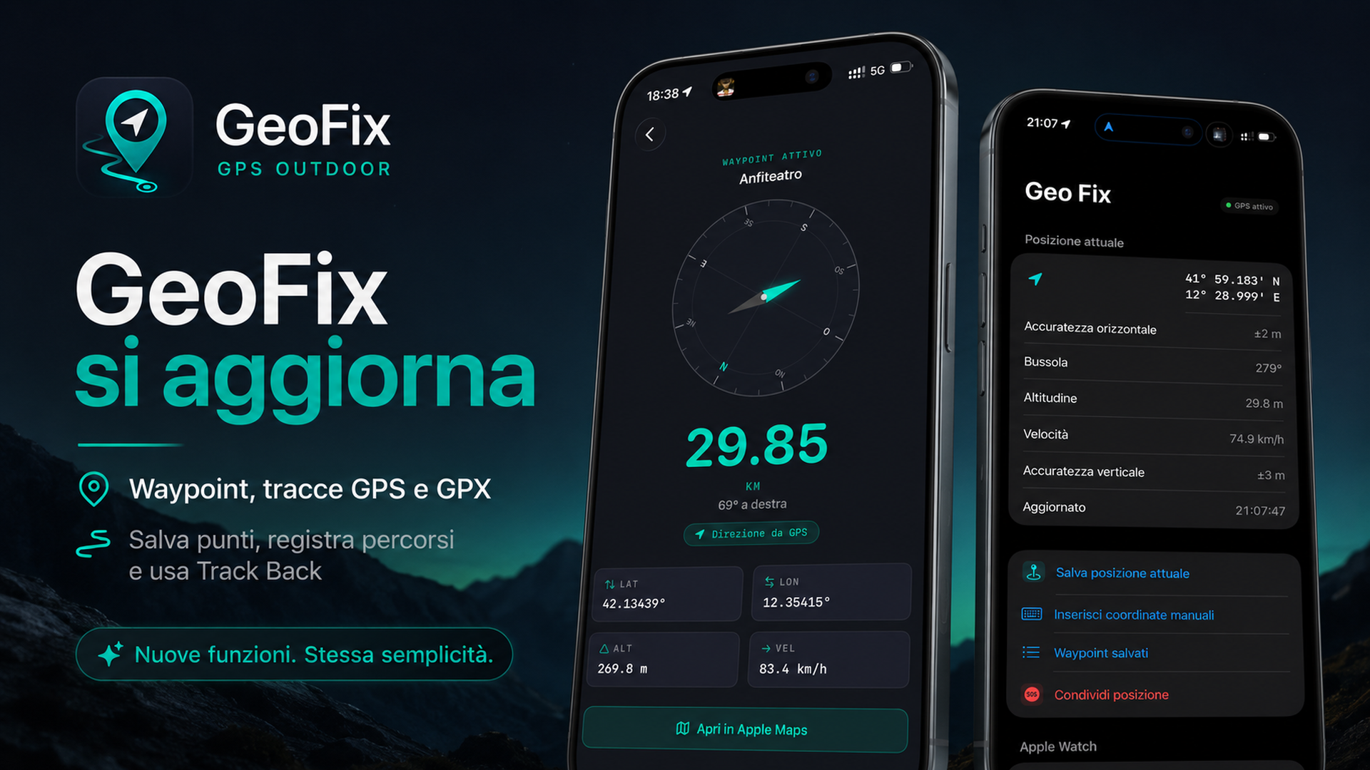
GeoFix is regularly updated with practical improvements for waypoints, GPS tracks, GPX, Apple Watch and real outdoor use. The goal is not to add random features, but to make the app clearer, more reliable and more useful in the field.
Short answers before downloading an outdoor GPS app.
Yes. Waypoints, tracks and essential navigation use GPS, compass and local data. A connection may be needed for the App Store, Apple Maps or sharing through external apps.
Yes. You can save a waypoint before leaving and use it as a reference to head back toward that point.
Yes. GeoFix supports GPX import/export for tracks and waypoints. Some GPX features may require Premium.
No. It is an essential GPS tool, not a rescue system or a professional mapping product.
Yes. GeoFix includes Apple Watch support for essential outdoor references.
Yes. With GeoFix 2.11, you can use CarPlay to view waypoints and GPS tracks, start essential navigation, use Forward/Track Back and end navigation from the CarPlay dashboard. GeoFix does not display CarPlay maps and does not replace a road navigation app.
Save your starting point, record the track and use Track Back when you need to retrace your steps.
Download on the App Store